

Map of Costa Rica
Politics:
Costa Rica has had a democracy for over 100 years with a couple of very brief lapses. In 1948 they abolished their military, thus allowing themselves to afford good education and healthcare. They have an elected President and an elected uni-cameral house of representatives. The recent Past President, Oscar Arias, holds a Nobel Peace Prize from a former term as President in the late ‘80’s when he made great strides in bringing peace to his neighboring countries. The current administration clearly recognizes the economic power of tourism and investment by outsiders and cooperates openly with a number of trade partners including China and of course, the U.S. Costa Rica has now ratified CAFTA, the Central American Free Trade Agreement. It was the last country to do so and internally required a referendum. President Arias had more or less hung his term on joining CAFTA and succeeded.
Geography:

The Caribbean and Central America
Costa Rica has long coastlines on both the Atlantic and Pacific. For meteorological, historical and cultural reasons, the Atlantic/Caribbean coast is virtually undeveloped and is likely to remain so for some years to come. The country is about 50% larger than New England minus Maine. The population is about the same as that of Connecticut, 4,000,000 people. Costa Rica’s population density is 86 persons/sq. mi. Nebraska’s by comparison is 22 while Connecticut’s is more than 700. Three quarters of the population of the country lives in the central valley, in the mountains around the capital city of San Jose, roughly in the center of the country which is about 150 miles wide and 250 miles long. Costa Rica’s northern/western border is the country of Nicaragua while it’s southern/eastern border is the country of Panama. Costa Rica lies between about 9 degrees latitude north and 11 degrees latitude north of the equator (around 500 miles). It lies between about 80 degrees west longitude and 90 degrees west longitude, roughly due south of Detroit, MI, Atlanta, GA, and Panama City, FL. It is 2,000 air miles from New York City to San Jose with Miami at the half-way mark. The flight time from NYC is 5 hours. From Miami, about 2 ½ hours. A little bit longer from Atlanta or Houston. If one were to sail due west from the town of Tamarindo along the north Pacific coast, the first significant landfall would be the Philippines, well past the International Date Line, then bumping into Ho-Chi-Min City Vietnam, passing through southern Thailand, central Africa, and then hitting the Caribbean coast of Venezuela. The Continental Divide runs down the center of the country and reaches about 13,000 feet (3,820 meters) of altitude at the peak of Chiro Chiripo in the southern part of the country. There are five active volcanoes along the range of mountain peaks that form the center backbone of the country. For a rather small country, the variance in the geography is something you will notice, ranging from open valleys, dry tropical forest, steep mountains, rain forest, and verdant agricultural areas.
Economy:
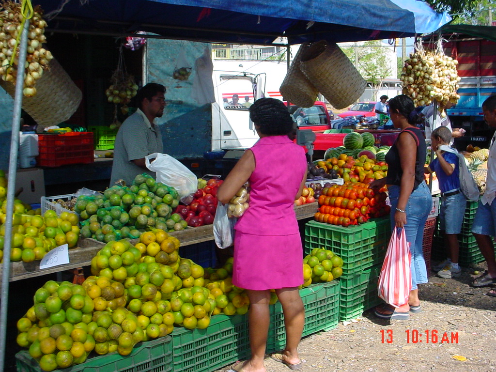
The Farmer’s Market on Saturday Morning at Santa Cruz
Traditionally, Costa Rica’s economy was driven by agriculture, mostly coffee and sugar, and in the past, but no longer, pineapple. The country has a modern telecommunications infrastructure and a well educated population with many English speakers so in recent decades it has seen a great deal of growth in the technology sector with Intel leading the way. Today it is also becoming a hotspot for call center outsourcing.
However, tourism is rapidly becoming the leading economic engine. The Pacific Northwest Province of Guanacaste, in particular is being transformed by the forces of tourism and foreign investment. Costa Rica is one of the most ecologically robust countries in the world. Comprising about 1% of the world’s land mass it nevertheless holds more than 5% of the world’s species. Because it lies in the middle of a land bridge joining the north and south American continents, it has been exposed to many species of plants and animals from both directions.
The people of Costa Rica long ago recognized the importance of their environment. They lead the world in several environmental categories including having more than 25% of their land in protected parks and in production of electricity from renewable sources including hydroelectric, wind, and geothermal generation of power. They generate very close to 100% of their electricity from renewable sources. They have set a goal to be a carbon-neutral country in the next decade or so.
As a result, eco-tourism has been a major factor in bringing visitors to their country and surely will continue to be, but a shift is underway. More and more visitors are seeing Costa Rica as a desirable tropical vacation spot and while most visitors still want to do a canopy tour or a white water raft trip or sport fishing, more and more are also playing golf, dining, and just going to the beach.
This new kind of tourist brings a lot more money to spend than did the traditional back-packers.
